Drone Photography for Real Estate: Elevate Your Listings
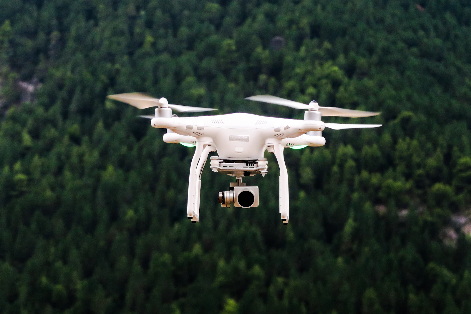
Nothing showcases a property's full potential like aerial photography. Drone photography for real estate reveals lot size, neighbourhood context, and proximity to amenities in ways ground-level photos simply cannot. For Ontario agents listing properties with notable lots, waterfront access, or scenic locations, drone imagery has become essential.
According to MLS data, listings with aerial photography receive 68% more views than those without. For properties where location and outdoor space are selling points, that advantage is even greater.
Why Drone Photography Matters
Visual Impact
Aerial photography captures:
- Full property scope and lot size
- Relationship to neighbours and privacy
- Backyard features (pools, gardens, patios)
- Proximity to parks, water, amenities
- Neighbourhood character and density
Buyer Psychology
"The drone shot sold me before I even walked through the door."
Aerial imagery helps buyers:
- Understand the property in context
- Appreciate lot size and outdoor space
- Visualize neighbourhood lifestyle
- Make faster initial judgments (positive or negative)
Properties That Benefit Most
| Property Type | Drone Impact |
|---|---|
| Waterfront/Lakefront | Essential |
| Acreage/Rural | Essential |
| Properties with pools | High |
| Corner lots | High |
| Backing onto parks | High |
| Urban condos | Lower (focus on views) |
| Townhomes | Moderate |
Canadian Drone Regulations
Transport Canada Requirements
Before flying drones commercially in Canada, you must:
Basic Operations (lower risk):
- Pass Basic Pilot Certificate exam
- Fly only in uncontrolled airspace
- Keep drone below 122m (400ft)
- Maintain visual line of sight
Advanced Operations (required near airports, people):
- Pass Advanced Pilot Certificate exam
- Fly Transport Canada-certified drone
- Can operate in controlled airspace (with authorization)
- Can fly near people
Real Estate Implications
Most real estate drone work requires Advanced certification because:
- Properties often near airports (GTA especially)
- Neighbours may be in proximity
- Controlled airspace covers much of southern Ontario
Getting Certified
- Study Transport Canada materials (free online)
- Pass online exam ($10 fee)
- For Advanced: Complete flight review with certified examiner
- Register your drone
- Carry proof of certification while flying
Time investment: 20-40 hours of study + flight practice
Insurance Requirements
Commercial drone operators should carry:
- Liability insurance ($1-2M minimum)
- Proof often required for permits
- Some brokerages require coverage
Hiring Professional Drone Operators
What to Look For
✅ Transport Canada certification (ask for number) ✅ Liability insurance (ask for certificate) ✅ Real estate portfolio (quality varies widely) ✅ Professional editing included ✅ Quick turnaround (24-48 hours ideal)
Cost Expectations
| Service | GTA Price Range |
|---|---|
| Drone photos only | $150-300 |
| Drone + ground photos | $300-500 |
| Drone video | $200-350 |
| Full package (photos + video + ground) | $500-800 |
| Luxury property package | $1,000+ |
Questions to Ask
- "Can I see examples of your real estate work?"
- "What's your turnaround time?"
- "How many images/minutes of video included?"
- "Do you have controlled airspace authorization?"
- "What happens if weather delays the shoot?"
Best Practices for Great Drone Shots
Timing
Best Times:
- Golden hour (sunrise/sunset) for dramatic lighting
- Midday for sharp shadows and clear detail
- Overcast days for even lighting (no harsh shadows)
Worst Times:
- High noon in summer (harsh, flat lighting)
- Low sun angle in winter (long shadows, dim)
- Immediately after rain (wet surfaces, fog)
Weather Considerations
Ideal Conditions:
- Light wind (under 15 km/h)
- No precipitation
- Good visibility
- Stable temperatures
Cannot Fly:
- Rain, snow, or fog
- High winds (over 30 km/h)
- Extreme cold (battery issues)
Seasonal Tips
Spring: Capture fresh landscaping, avoid mud Summer: Lush greenery, pool season, longest days Fall: Foliage colours (spectacular in Ontario) Winter: Property boundaries visible, unique appeal for year-round buyers
Shot Composition
Essential Angles
1. Front Elevation (45° angle)
- Shows front yard and house together
- Height: 15-20m
- Most common primary listing photo
2. Overhead/Bird's Eye
- Shows lot boundaries and layout
- Height: 30-50m
- Great for acreage properties
3. Side Angles
- Reveals depth of property
- Shows relationship to neighbours
- Captures side yards and access
4. Backyard Focus
- Pool, deck, garden features
- Privacy from neighbours
- Lower angle (10-15m)
5. Neighbourhood Context
- Higher altitude for surroundings
- Nearby amenities visible
- Location selling point
Video Best Practices
Standard Real Estate Drone Video:
- 60-90 seconds total
- Smooth, slow movements
- Variety of heights and angles
- Musical soundtrack (licensed)
- Opening reveals property
- Closing with address/branding
Movement Tips:
- Slow and steady always
- Reveal shots (start behind, move forward)
- Orbit (circle the property)
- Top-down drop (high to low)
- Pull-back (close to wide)
Editing and Delivery
Photo Editing
Standard adjustments:
- Exposure and contrast balancing
- Colour correction for sky
- Lens distortion correction
- Horizon straightening
- Minor blemish removal (cars, garbage bins)
Video Editing
Include:
- Colour grading for consistency
- Smooth transitions between clips
- Background music (licensed)
- Opening title with address
- End card with contact info
Delivery Formats
Photos:
- High resolution for print (300 DPI)
- Web-optimized (72 DPI, compressed)
- Both landscape and square crops
Video:
- 4K master file
- 1080p compressed for web
- Vertical edit for Instagram Stories/Reels
Restrictions and No-Fly Zones
GTA Specific Challenges
The Greater Toronto Area has significant airspace restrictions:
- 5.6 km from Toronto Pearson = no drone zone without authorization
- Billy Bishop Airport impacts downtown Toronto
- Many private airports and heliports
- Protected areas (military, nuclear facilities)
Checking Before You Fly
Use these resources:
- NAV Drone app (Transport Canada official)
- AirMap (comprehensive airspace info)
- Drone Site Selection Tool (Canada.ca)
Controlled Airspace Authorization
If property is in controlled airspace:
- Submit authorization request via NAV Drone
- Allow 10+ days for processing
- Receive flight clearance
- Follow all conditions specified
For busy real estate schedules, work with photographers who already have blanket authorizations.
Integrating Drone Content
Listing Presentation
- Use drone shot as primary MLS image
- Include 2-3 aerial photos in gallery
- Lead virtual tour with fly-in video
- Save overhead shot for lot discussion
Social Media
- Drone video clips for Reels/TikTok
- Aerial photos for standard posts
- Before/after construction comparisons
- Neighbourhood highlight content
Print Marketing
- Aerial shots work well for flyers
- Include in feature sheets
- Use for farming materials
RealtorFlyer makes it easy to incorporate your aerial photography into professional listing flyers—simply upload your drone shots and let AI design stunning materials.
DIY vs. Professional
Going DIY
Pros:
- Lower per-listing cost (after equipment)
- Flexibility in scheduling
- Creative control
Cons:
- Significant learning curve
- Certification time investment
- Equipment costs ($1,500-5,000+)
- Liability concerns
- Editing time
Best For: Agents listing 30+ properties/year who want full control
Hiring Professional
Pros:
- Immediate professional quality
- No learning curve
- No equipment investment
- Editing included
- Liability on photographer
Cons:
- Per-listing cost
- Scheduling coordination
- Less creative control
Best For: Most agents—focus on selling, not flying
Common Mistakes to Avoid
- Flying illegally (no certification, wrong airspace)
- Poor timing (harsh midday light, winter shadows)
- Too much altitude (property becomes unrecognizable dot)
- Shaky footage (always use tripod mode, avoid wind)
- Ignoring neighbours (privacy concerns, flying over property)
- Missing key features (forget to capture pool, unique lot shape)
Building Your Drone Marketing Strategy
Starter Approach
- Partner with 1-2 reliable drone photographers
- Include aerial package for listings $750K+
- Use footage across all marketing channels
- Track engagement differences
Advanced Approach
- Get certified yourself (time investment pays off)
- Offer drone photography as listing differentiator
- Create neighbourhood highlight content
- Develop signature aerial style
Get Real Estate Marketing Tips
Join thousands of Canadian realtors who receive our weekly marketing guides and flyer templates.
No spam. Unsubscribe at any time.
